Didcot Power Station A
We were contracted by Clowes Developments (UK) Limited to carry out the enabling package at Didcot Power Station A – located within Oxfordshire County Council.
The site, historically used as a ministry of Defence (MOD) depot, later became Didcot Power Station A – a 2,000 MWe sub-critical coal and gas fired power station. The power station ceased operations following the EU’s Large Combustion Plant Directive. After over 40 years of power generation, the station was decommissioned and disconnected from the National Grid necessitating the cessation of generation by the end of December 2015, marking the closure of Power Station “A”.

forty
years of power generation
35
hectare site
960m
watercourse designed and installed
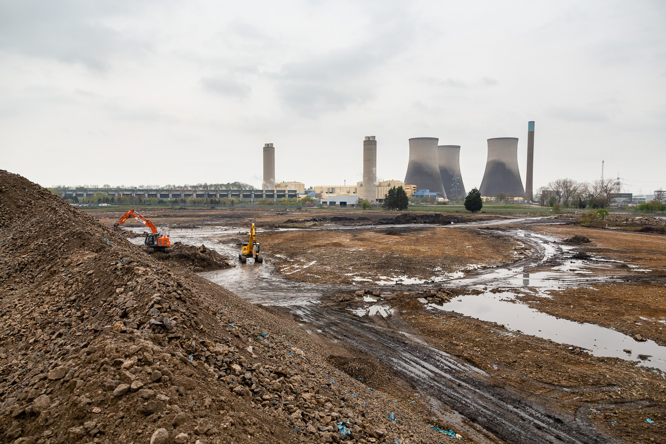
Spanning 35 hectares, the site was bordered to the North and East by the remaining Didcot Power Station “B” site, to the South by Milton Road, beyond which was the Great Western Mainline and the A4130, and to the West by a recently constructed steel-framed warehouse. The majority of the site was covered with a 300mm RC slab with several large flooded voids and multiple stockpiles in the South-East and South-West areas; notably, there was a 70,500m3 stockpile of pulverised fuel ash, a by-product generated during the power station’s coal and oil manufacturing period.
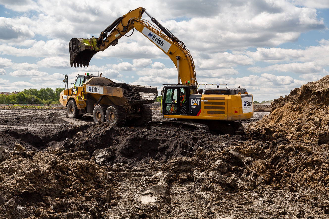
Works at the power station were undertaken in a linear multi-phased sequence executed under JCT D&B 2016. The enabling works included groundwater treatment and disposal, demolition of a number of underground structures to 2m below ground level and crushing, screening and testing of subsequent arisings.

The second stage of the multi-phased project consisted of the earthworks, land re-profiling, and civil works. The phase began with the clearance of approximately 55,000m2 of topsoil, trees and associated vegetation. In-situ and ex-situ bioremediation we conducted alongside the cut and fill, compaction and chemical and geotechnical testing of approximately 120,500m3 of material. Additionally, 19,000m3 of grouting was completed to address various underground obstructions utilising an 80:1 PFA/OPC mix. The demolition of an above ground reinforced concrete treatment lagoon facilitated the placement of a capping layer across the site serving as a working platform for a piling rig.
Stage three at Didcot involved the design and construction of a 960m watercourse, including the break-out and diversion of an existing watercourse. The new watercourse spanned fifteen metres in width and up to three and half metres in depth with connections made from an existing 1500 box culvert that carried the existing watercourse from Milton Road to the south. The profiled excavation resulted in over 50,000m3 of reworked natural clay.
Innovation
The site team developed an innovative grid overlay system for use with Google Earth. This system facilitated the referencing of the percentage of work completed on site in conjunction with standard GPS survey equipment. It also assisted all site staff to referencing their individual parcels of work when explaining issues, as they all had the grid overlaid on Google Earth. When using the Google Earth map location tool, it showed exactly which work grid they were in.